Research Project
AI-Enhanced Flood Storytelling
Mobilizing action and building resilience in underserved communities through narrative-driven AI.
The University of Alabama · Department of Computer Science
The Problem
Warnings don’t save lives. Stories do.
Current flood warning systems leave communities vulnerable due to a critical breakdown in risk communication. Despite robust scientific data, warnings fail to translate into protective behavior.
Our Approach
From data silos to actionable knowledge
A closed-loop pipeline: listen, explore, broadcast.
Ground
The Knowledge Graph grounds every answer in a validated flood ontology and government guidance documents.
Explore
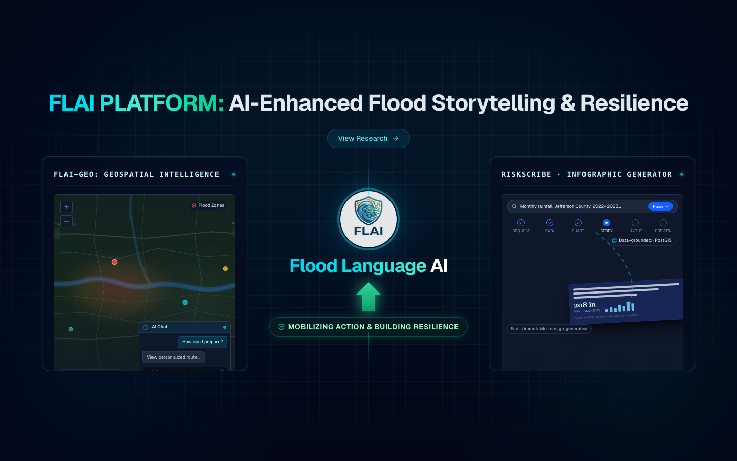
FLAI-Geo, the conversational geospatial assistant, synthesizes map layers on demand through plain-language dialogue.
Broadcast
RiskScribe, the infographic generator, produces clear, tailored public infographics whose facts are immutable and verifiable.
Goal: Empower decision-makers to mobilize equitable community resilience in real time.
System Design
Core Architecture
Knowledge Graph (backend)
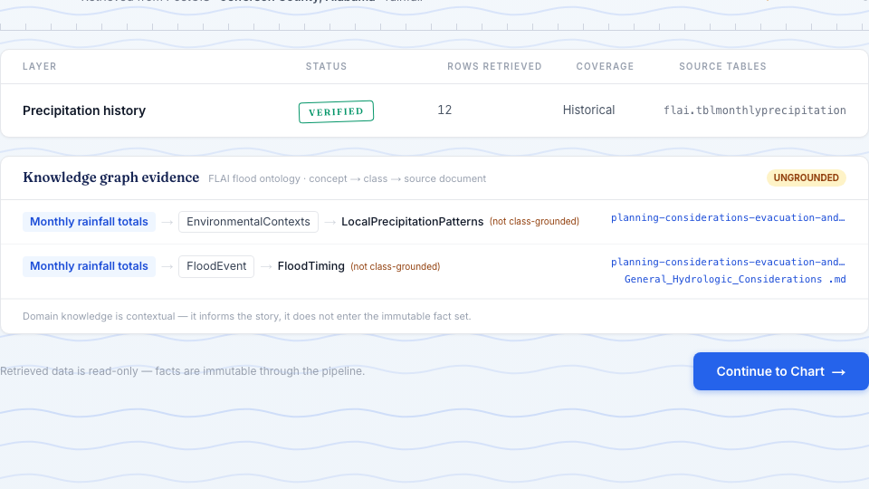
- Flood ontology + government-guidance leaf nodes, indexed for semantic retrieval (FAISS); the shared PostGIS store holds the measured facts (land cover, rainfall, SVI, flood events, gauges, infrastructure).
- Both modules call the same evidence router; RiskScribe shows the resulting concept → class → source-document paths next to the retrieved data.
- Grounds explanations in validated concepts and keeps generated design separate from immutable facts.
FLAI-Geo: Geospatial Intelligence
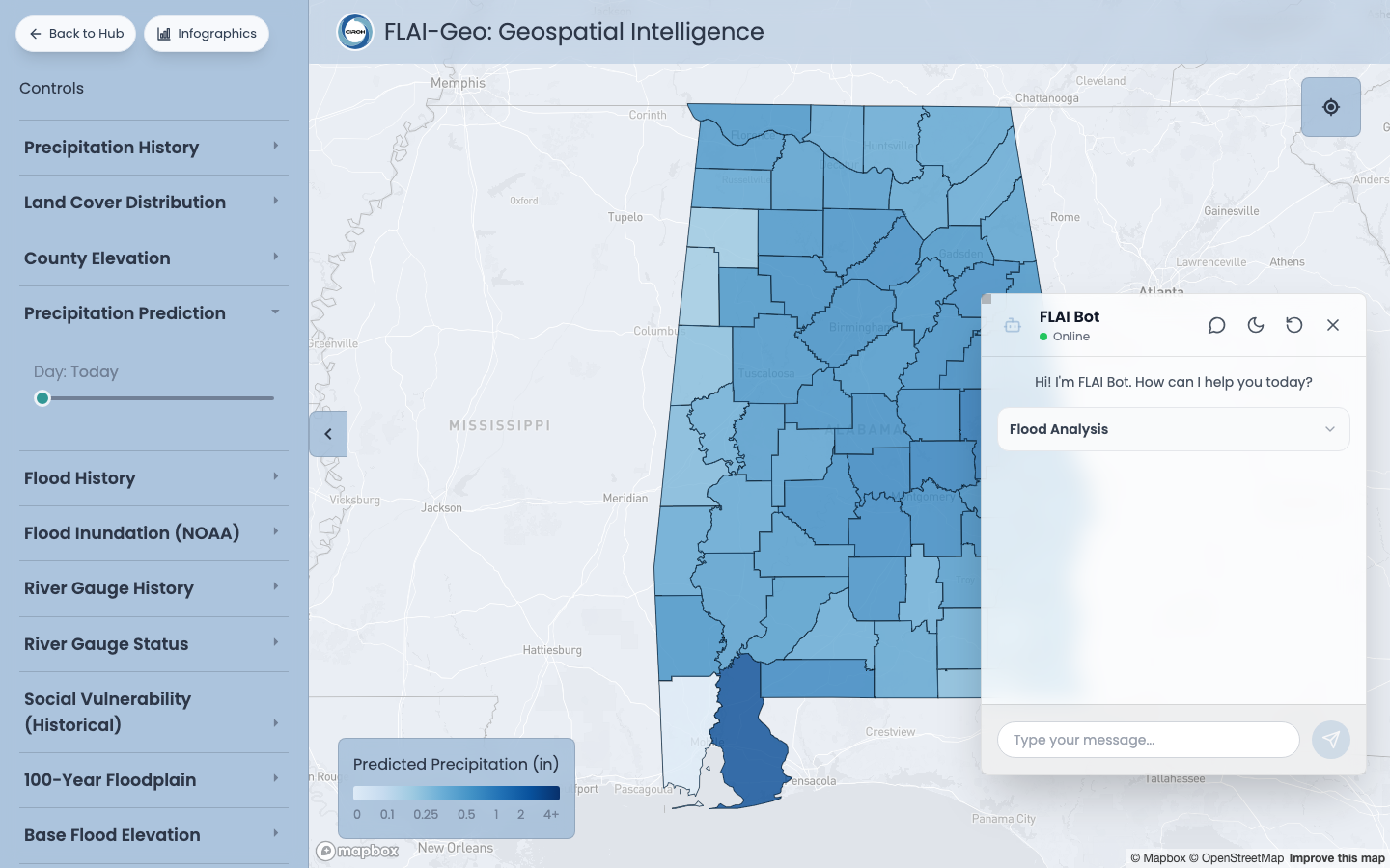
- Conversational AI assistant enabling users to perform geospatial and conversational exploration using plain language.
- Graph Synthesis: Aggregates diverse data layers in real time to answer complex, multi-variable queries.
- Combined Reasoning: Leverages the Knowledge Graph to translate raw spatial data into coherent, context-aware advisories.
- One click hands a conversation to RiskScribe to turn it into an infographic.
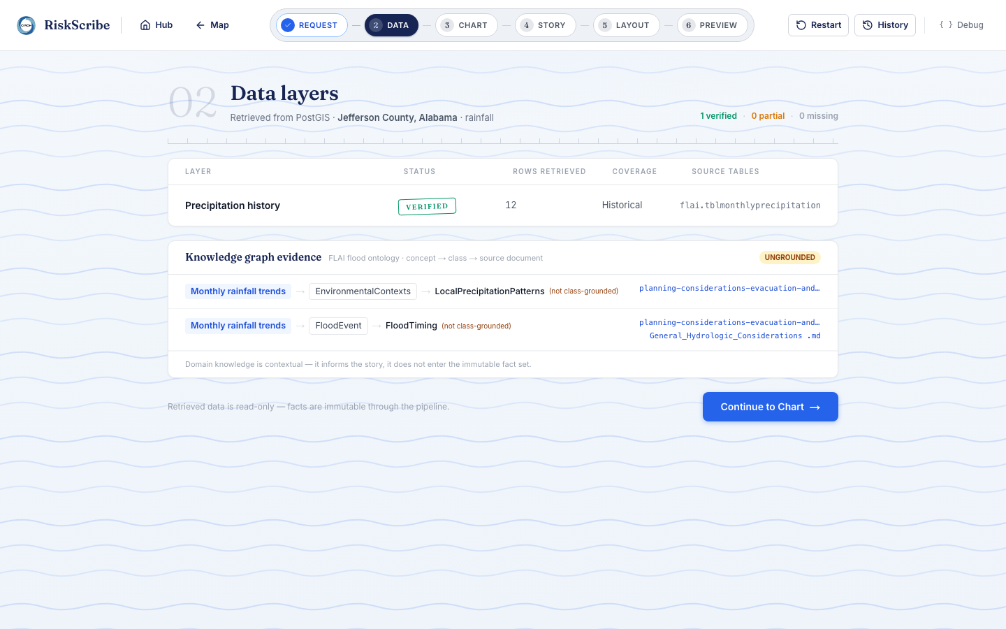
RiskScribe: Infographic Generator
- Public Broadcasting: Distills raw data into diverse narratives for immediate public consumption (e.g., situation reports, warnings).
- Tailored Synthesis: Users customize tone and content, while the generator arranges synthesis across cards and visuals.
- Strictly Grounded: All generated content is anchored in the FLAI KG.
- Six steps — Request, Data, Chart, Story, Layout, Preview — with ranked, constrained choices; a final decoration step restyles the render while the data stay unchanged.
Key Contributions
What we built
A novel Human-in-the-Loop Knowledge Graph as the semantic brain for community-level flood resilience.
Dual AI Storytelling Modes—FLAI-Geo, the conversational geospatial assistant, and RiskScribe, the infographic generator—bridging technical flood data with plain-language narratives.
End-to-end platform connecting KGs and LLMs to transform scattered flood data into actionable, localized knowledge for underserved communities.
Publications
Research Output
RiskScribe: Verifiable Generative Visualization for High-Stakes Public Communication
Fabricio Joel Gutierrez Juarez, Shenglin Li, Margulan Baizhakyp, Jiaqi Gong — Submitted to AAAI 2027
Shenglin Li, Margulan Baizhakyp, Fabricio Gutierrez Juarez, Jiaqi Gong, et al. — Research Square preprint · 2026
A Semi-Automated Framework for Flood Ontology Construction with an Application in Risk Communication
Shenglin Li, Jiaqi Gong, et al. — Water 2025 · 17(19), 2801
Shenglin Li, Jiaqi Gong, et al. — Hydrology 2025 · 12(8), 204
The People
Research Team
Dr. Jiaqi Gong
Project Lead
Principal Investigator
Dr. Shenglin Li
Technical lead
Fabricio Joel Gutierrez Juarez
Research Assistant
Margulan Baizhakyp
Research Assistant